


Mapping Shallow Reefs Using Low-cost Side Scanning Sonar and Drone Photography Systems
Purpose/Objectives
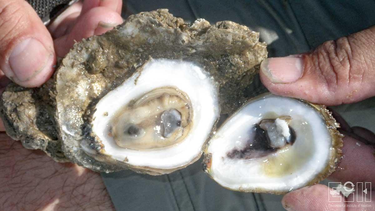
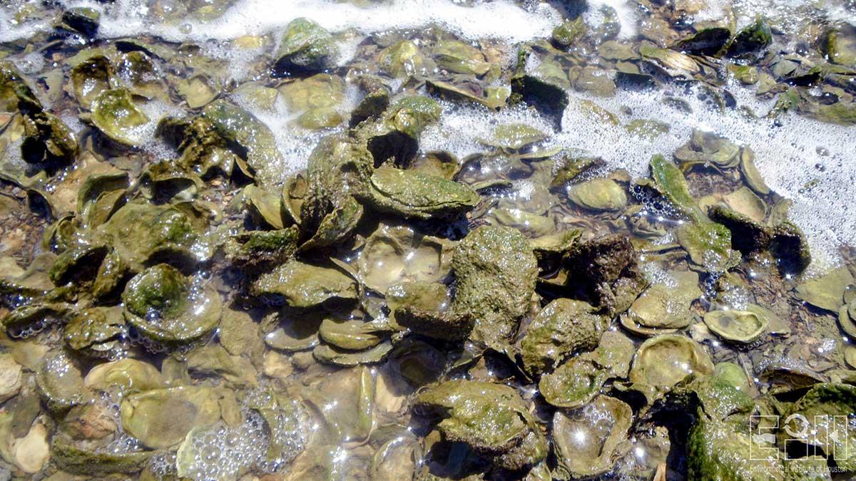
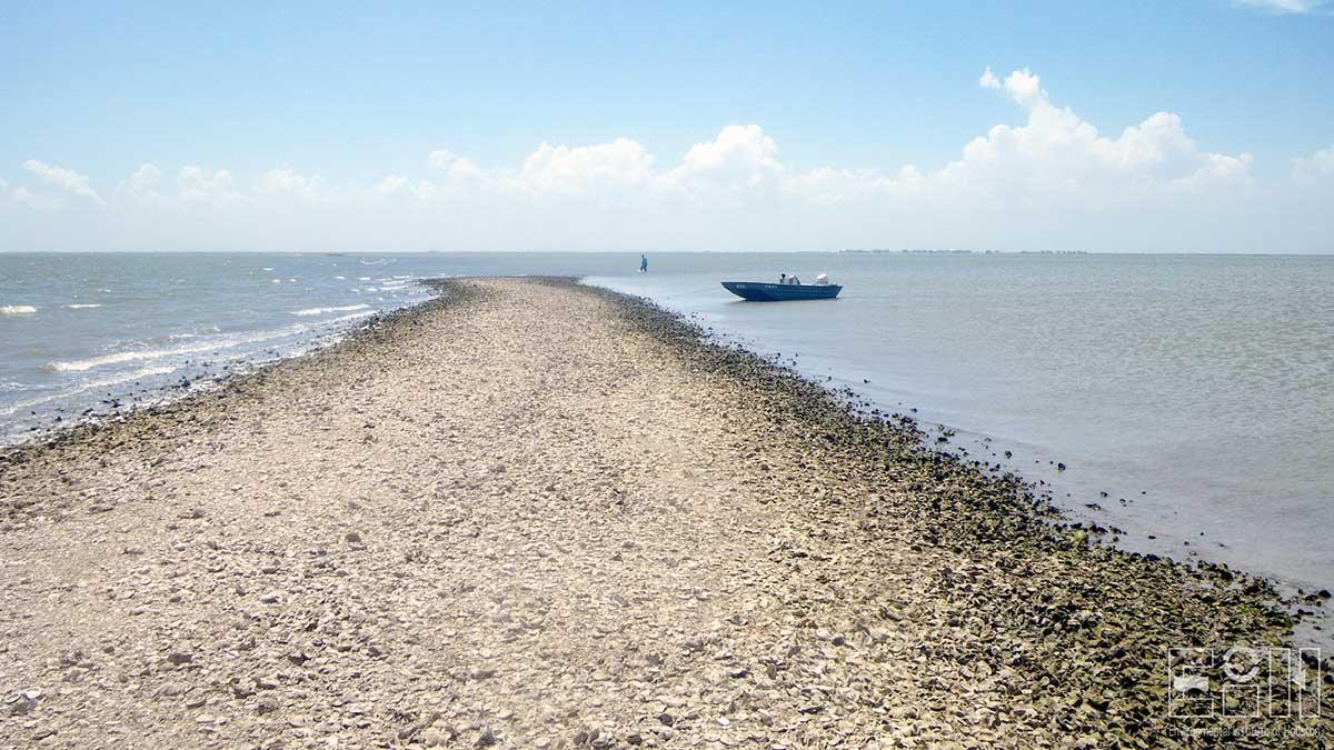
Oyster reefs are important environmental and economic resources within the coastal regions of the United States. Mapping the physical extent of oyster reefs provides scientists and managers more complete data on the current status of oyster populations that can be valuable economically as wells as for ongoing oyster restoration efforts. The goal of this project is to apply side-scanning sonar system (for deeper water) combined with drone photography (for shallow water) together with digital image processing techniques in order to map shallow and intertidal oyster reefs and shell bottom at selected sites along the Texas coastal zone.
Study Area
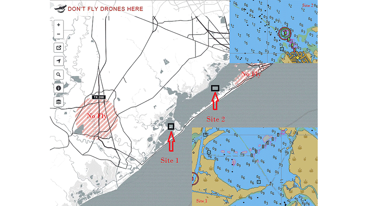
Several questions/criteria are used to evaluate and select the research sites to conduct shallow and intertidal shell and reef mapping including the following: 1) Is there sufficient water depth to allow easy and safe navigation of a small utility boat equipped with side scanning sonar system; 2) Do the sites contain areas of extremely low water (< 1 m) and exposed intertidal habitat due to low astronomical tides or meteorological induced low water conditions (e.g., cold fronts); and 3) Are the sites sufficiently far enough from airports to comply with all Federal Aviation Administration (FAA) flight restrictions?
Based on the above, two main candidate sites are identified for investigation: Site 1) the Bastrop Bay where the mean lower low water level has been historically recorded as low as 0.9 m; and Site 2) the Carancahua reef area in West Bay where the mean lower low water level is also reaches 0.9 m. Other sites near South Deer Island and North Deer Island provide excellent potential locations for the side scanning sonar survey. We will, however, continue to attempt to secure permission or obtain an exemption depending on flight altitude so we can survey this area as well.
Project Period
2015 – 2016
Description
The project involves two main phases:
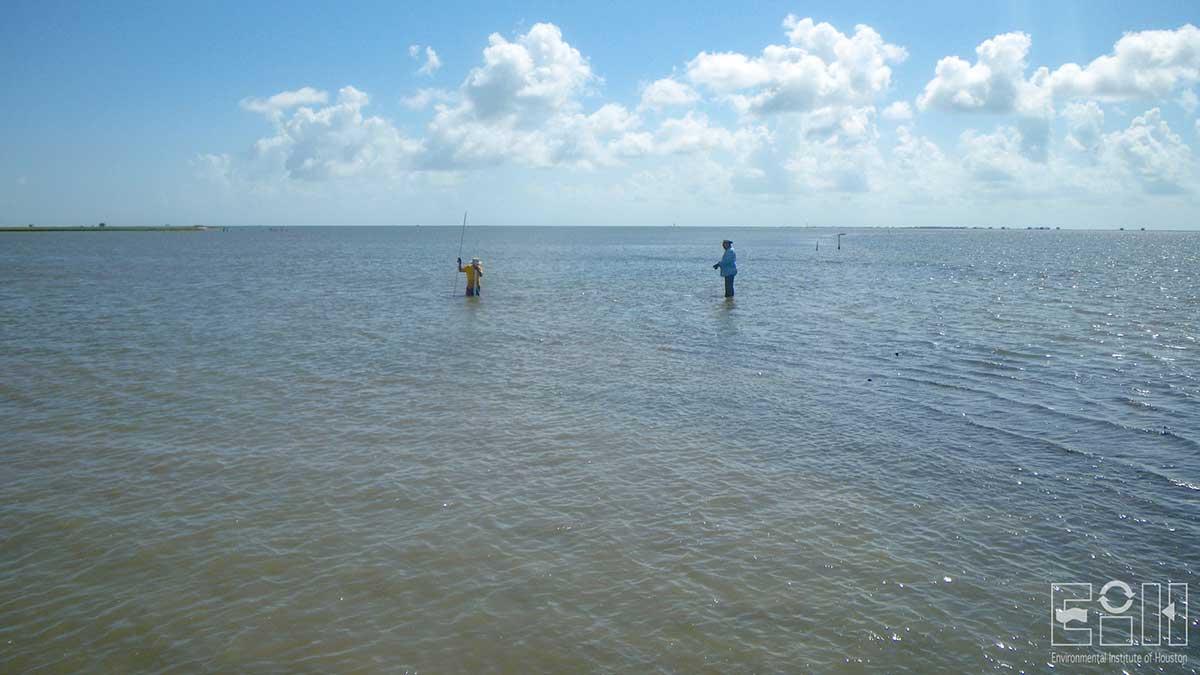
1) Side scanning sonar mapping: during the planning process one of the first steps we will implement is the establishment of sufficient transect routes to capture subsequent sonar images that are partially overlapped to ensure no gaps exist in the final products. The fieldwork will be conducted during calm wind 1 to 2 days after the passage of a strong northern cold front at approximately high tide time to ensure proper functioning of survey equipment in shallow water.
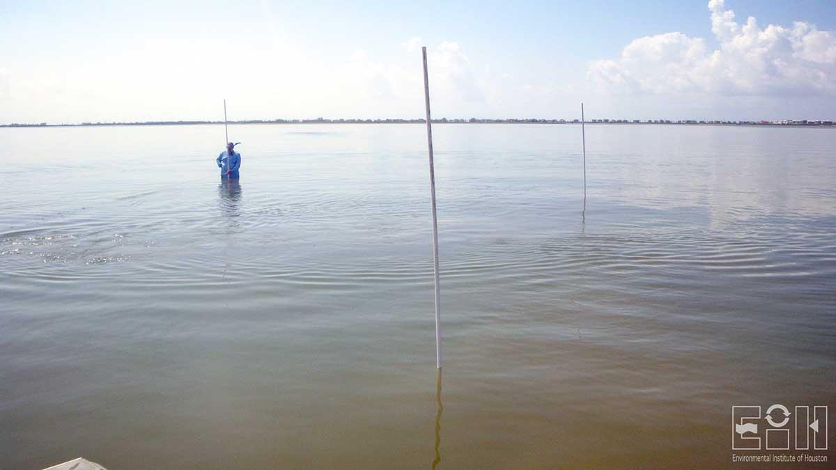
2) Drone mapping: high resolution digital cameras placed on an unmanned aerial vehicle (UAV) will be used to collect high resolution images at selected sites to evaluate the ability to map intertidal reefs at reasonable costs. UAV photography in bay systems where oyster reefs sites are located can be ideal when water is at the lowest level. This may happen when low pressure meteorological systems exist off shore combined with wind that blows seaward leading to water levels that can be lower than lowest tidal levels. Each flying mission will be conducted using a detailed flight plan in regard to the exact flying orientation, route, number of flying lines, and number of images, end laps and side laps. Sufficient ground control points for image rectification/registration will be ensured using visible features where possible and anchored floating objects at know locations. The collection of remote sensing images using this technique will be digitally processed through multiple steps that include spatial rectification and registration, spectral enhancement and classification.
We will conduct an additional literature review of recent and potential technologies used to map intertidal and shallow (< 1-2 meter) oyster reef and monitor oyster reef conditions. This will be done to supplement the proposed field study that is based on our past review of methods that show the greatest flexibility and likelihood of success. We will also develop general protocols and recommendations for the application of both side scanning sonar and drone technologies in addition to the specific guidelines we will develop for the methods and gear we will use during our field study.
Publications and Presentations
Guillen, G. and Mokrech, M. 2018. Mapping shallow reefs using low-cost scanning sonar and drone photography systems. EIH Technical Report 18-001:72.
Guillen, G. and Mokrech, M. 2017. Mapping shallow reefs using low-cost side scanning sonar and drone photography systems. Gulf Coast Prairie Landscape Conservation Cooperative, Lafayette, LA. Webinar.
Mokrech, M., Guillen, G., and Yokley, J. 2016. Low-cost mapping of intertidal reefs using side-scanning sonar and UAV systems. In Restore America's Estuaries, New Orleans, LA. Poster.
Project Sponsors
- Gulf Coast Prairie Landscape Conservation Cooperative
Related links
- HAWK1 approved to take flight
Contact
-
Environmental Institute of Houston
Phone: 281-283-3950
Email: eih@uhcl.eduNorth Office Annex
2700 Bay Area Blvd, Box 540
Houston, TX 77058-1002

